14527+0746 HLD 120 AB (HD 131303)
14h 52m 39.21s +07° 46' 25.4" P.A. 226.00 sep 15.6 mag 8.05,11.60 Sp K0
| Coord 2000 |
14527+0746 |
|
Discov num |
HLD 120 |
|
Comp |
AB |
|
Coord arcsec 2000 |
14 52 39.21 +07 46 25.4 |
|
| Date first |
1882 |
|
Date last |
2019 |
|
Obs |
26 |
|
| Pa first |
220 |
|
Pa last |
226.3 |
|
P.A. Now (θ) |
226.3° |
|
| Sep first |
15.0 |
|
Sep last |
15.61 |
|
Sep. Now (ρ) |
15.61" |
|
| Mag pri |
8.05 |
|
Mag sec |
11.60 |
|
delta mag (ΔM) |
3.55 |
|
Spectral class |
K0 (yellow-orange) |
|
| Pri motion ra |
-047 |
|
Sec motion ra |
-007 |
|
| Pri motion dec |
-053 |
|
Sec motion dec |
-004 |
|
| Notes |
N
(See Notes) |
|
rPM=0.893
This double is not physical.
14527+0746 SYSTEM COMPONENTS
| Show |
name |
SAO |
coord |
wds_name |
last |
obs |
pa |
sep |
mag1 |
mag2 |
d_mag |
orb |
current |
| Show |
HD 131303 |
120708 |
14 52 39 +07 46 25 |
HLD 120 AB |
2019 |
26 |
226 |
15.6 |
8.05 |
11.60 |
3.55 |
|
<=== |
| Show |
|
120708 |
14 52 39 +07 46 25 |
FOX 186 AC |
2017 |
10 |
42 |
98.7 |
8.05 |
13.77 |
5.72 |
|
|
Triple system
3 estimated visually detectable stars in this system
OTHER CATALOGS AND DESIGNATIONS
| Name |
HD 131303 |
|
Constellation |
Bootes |
|
SAO |
120708 |
|
Tycho2 |
0918-01301-1 |
|
| Gaia DR2 |
1161315691769448576 |
|
HD |
131303 |
|
WDS 14527+0746 HLD 120 AB (HD 131303) : NOTES
| discov_num |
notes |
refcode |
| HLD 120 |
AB. Schlimmer (2008) published linear elements rather similar to those |
Smr2008 |
|
in the Rectilinear Elements Catalog: x = -1.1407, y = -0.9315, |
|
|
To = 2229.42 +/- 1.74, sep= 1.473 +/- 0.2, PA = 309.24 +/- 0.5 |
|
REFERENCES
| refcode |
metd |
author |
reference |
| Smr2008 |
C j |
Schlimmer, J.S. |
2008JDSO....4...56S |
| Smr2008 |
|
JDSO 4, 56, 2008 |
|
DISCOVERER
| idgroup |
discov |
author |
| 1 |
FOX |
Fox, P. |
| 12 |
HLD |
Holden, E.S. |
WDS HISTORIC DATA
| coord_2000 |
discov_num |
comp |
epoch |
obs |
pa |
sep |
mag_pri |
mag_sec |
spectr |
notes |
coord_arcsec_2000 |
| 14527+0746 |
HLD 120 |
AB |
2008 |
11 |
224 |
16.1 |
8.05 |
10.84 |
K0 |
D |
145239.21+074625.4 |
| 14527+0746 |
HLD 120 |
AB |
2010 |
12 |
225 |
15.9 |
8.05 |
10.84 |
K0 |
N D |
145239.21+074625.4 |
| 14527+0746 |
HLD 120 |
AB |
2011 |
15 |
224 |
16.3 |
8.05 |
10.84 |
K0 |
N D |
145239.21+074625.4 |
| 14527+0746 |
HLD 120 |
AB |
2012 |
16 |
225 |
15.8 |
8.05 |
10.84 |
K0 |
N |
145239.21+074625.4 |
| 14527+0746 |
HLD 120 |
AB |
2015 |
17 |
226 |
15.6 |
8.05 |
10.84 |
K0 |
N |
145239.21+074625.4 |
| 14527+0746 |
HLD 120 |
AB |
2016 |
18 |
225 |
15.6 |
8.05 |
11.60 |
K0 |
N |
145239.21+074625.4 |
| 14527+0746 |
HLD 120 |
AB |
2017 |
19 |
224 |
16.1 |
8.05 |
11.60 |
K0 |
N |
145239.21+074625.4 |
| 14527+0746 |
HLD 120 |
AB |
2019 |
26 |
226 |
15.6 |
8.05 |
11.60 |
K0 |
N |
145239.21+074625.4 |
If you need more information about this double, apply for a
data request form to the WDS.
WDS 14527+0746 HLD 120 AB (HD 131303) : VISUAL OBSERVATIONS REPORTS
No records found.
WDS 14527+0746 HLD 120 AB (HD 131303) : MEASURES
No records found.
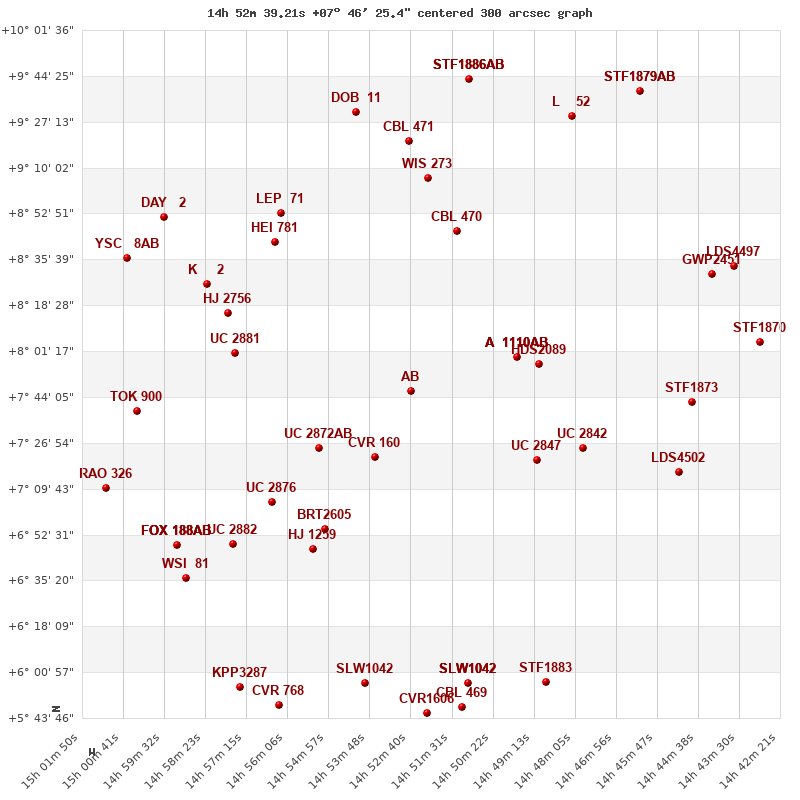
WDS 14527+0746 (HD 131303) : VIRTUAL EYEPIECE

Click on the map to see the double of your interest.
Pass over with the mouse cursor to display the catalog designation.
|
|
WDS 14527+0746 (HD 131303) : ALADIN DSS IMAGE @ 14h 52m 39.21s +07° 46' 25.4"
WDS 14527+0746 HLD 120 AB (HD 131303) : NEIGHBORHOODS
|
|
Click on the map to see the double of your interest.
Pass over with the mouse cursor to display the catalog designation.
|
| Show |
name |
coord_2000 |
discov# |
comp |
pa |
sep |
dist(') |
| Show |
|
14527+0746 |
HLD 120 |
AB |
226 |
15.6 |
|
| Show |
|
14527+0746 |
FOX 186 |
AC |
42 |
98.7 |
|
| Show |
|
14537+0721 |
CVR 160 |
|
180 |
24.0 |
30 |
| Show |
|
14552+0725 |
UC 2872 |
AB |
158 |
43.4 |
44 |
| Show |
|
14497+0759 |
A 1110 |
AB |
242 |
0.7 |
46 |
| Show |
|
14497+0759 |
A 1110 |
AB,C |
202 |
19.8 |
46 |
| Show |
|
14497+0759 |
A 1110 |
AB,D |
329 |
31.1 |
46 |
| Show |
|
14491+0756 |
HDS2089 |
|
194 |
0.5 |
54 |
| Show |
|
14491+0720 |
UC 2847 |
|
42 |
28.5 |
59 |
| Show |
|
14514+0846 |
CBL 470 |
|
145 |
14.1 |
63 |
| Show |
|
14550+0655 |
BRT2605 |
|
305 |
4.1 |
64 |
| Show |
|
14565+0705 |
UC 2876 |
|
275 |
43.2 |
72 |
| Show |
|
14554+0647 |
HJ 1259 |
|
79 |
33.0 |
72 |
| Show |
|
14576+0801 |
UC 2881 |
|
92 |
17.4 |
75 |
| Show |
|
14478+0725 |
UC 2842 |
|
52 |
59.0 |
75 |
| Show |
|
14564+0842 |
HEI 781 |
|
217 |
1.6 |
80 |
| Show |
|
14522+0906 |
WIS 273 |
|
178 |
937.8 |
80 |
| Show |
|
14578+0816 |
HJ 2756 |
|
90 |
24.1 |
82 |
| Show |
|
14563+0853 |
LEP 71 |
|
181 |
776.3 |
86 |
| Show |
|
14583+0826 |
K 2 |
|
323 |
53.7 |
94 |
| Show |
|
14576+0649 |
UC 2882 |
|
92 |
13.5 |
94 |
| Show |
|
14527+0920 |
CBL 471 |
|
139 |
15.9 |
94 |
| Show |
|
14542+0931 |
DOB 11 |
|
270 |
39.2 |
107 |
| Show |
|
14539+0557 |
SLW1042 |
|
102 |
117.1 |
112 |
| Show |
|
14511+0557 |
WSP 40 |
AB |
25 |
0.7 |
113 |
| Show |
|
14511+0557 |
WSP 40 |
AC |
190 |
11.3 |
113 |
| Show |
|
14511+0557 |
WSP 40 |
AD |
70 |
10.4 |
113 |
| Show |
|
14592+0649 |
FOX 188 |
AB |
21 |
19.5 |
114 |
| Show |
|
14592+0649 |
HJ 1263 |
AC |
104 |
17.2 |
114 |
| Show |
|
14592+0649 |
ABH 83 |
AD |
249 |
35.6 |
114 |
| Show |
|
14592+0649 |
ABH 83 |
AE |
79 |
72.7 |
114 |
| Show |
|
15003+0739 |
TOK 900 |
|
172 |
0.2 |
115 |
| Show |
|
14451+0717 |
LDS4502 |
|
161 |
16.4 |
116 |
| Show |
|
14589+0636 |
WSI 81 |
|
157 |
0.1 |
117 |
| Show |
|
14448+0742 |
STF1873 |
|
94 |
6.9 |
117 |
| Show |
|
14510+0943 |
STF1886 |
AB |
224 |
7.9 |
120 |
| Show |
|
14510+0943 |
SLE1028 |
AC |
71 |
127.5 |
120 |
| Show |
|
14510+0943 |
SLE1028 |
AD |
105 |
193.2 |
120 |
| Show |
|
14512+0548 |
CBL 469 |
|
13 |
25.6 |
121 |
| Show |
|
14522+0546 |
CVR1606 |
|
160 |
3.4 |
121 |
| Show |
|
14595+0851 |
DAY 2 |
|
7 |
388.7 |
122 |
| Show |
|
14482+0929 |
L 52 |
|
111 |
0.2 |
123 |
| Show |
|
14489+0557 |
STF1883 |
|
277 |
1.1 |
123 |
| Show |
|
15006+0836 |
YSC 8 |
AB |
158 |
0.1 |
128 |
| Show |
|
14564+0548 |
CVR 768 |
|
161 |
17.1 |
130 |
| Show |
|
14574+0555 |
KPP3287 |
|
350 |
10.9 |
132 |
| Show |
|
15012+0710 |
RAO 326 |
|
202 |
0.1 |
132 |
| Show |
|
14442+0830 |
GWP2451 |
|
112 |
87.2 |
133 |
| Show |
|
14437+0834 |
LDS4497 |
|
301 |
74.9 |
142 |
| Show |
|
14429+0805 |
STF1870 |
|
229 |
4.8 |
146 |
| Show |
|
14463+0939 |
STF1879 |
AB |
82 |
1.7 |
148 |
|
|
WDS 14527+0746 : COMPONENTS
| |
A |
B |
| B |
pa=226.0°
sep=15.54"
| |
| C |
pa=42.1°
sep=98.29"
| pa=42.7°
sep=113.79"
|
14527+0746 A
| Name |
HD 131303 |
|
Coord arcsec 2000 |
145239.21+074625.4 |
|
Mag |
8.05 |
|
Spectral class |
K0 (yellow-orange) |
|
| PmRA |
-47.00 |
|
PmDE |
-53.0 |
|
SAO |
120708 |
|
Tycho2 |
0918-01301-1 |
|
| HD |
131303 |
|
DM |
BD+08 2931 |
|
| Tycho2 |
0918-01301-1 |
|
Pflag |
|
|
RAmdeg |
223.16339912 |
|
DEmdeg |
7.77373787 |
|
| PmRA |
-47.6 |
|
PmDE |
-53.9 |
|
E RAmdeg |
6 |
|
E DEmdeg |
9 |
|
| E pmRA |
1.4 |
|
E pmDE |
1.4 |
|
EpRAm |
1991.56 |
|
EpDEm |
1990.95 |
|
| Num |
10 |
|
Q RAmdeg |
0.5 |
|
Q DEmdeg |
0.4 |
|
Q pmRA |
0.6 |
|
| Q pmDE |
0.5 |
|
BTmag |
9.208 |
|
E BTmag |
0.020 |
|
VTmag |
8.046 |
|
| E VTmag |
0.013 |
|
Prox |
999 |
|
TYC |
T |
|
HIP |
|
|
| CCDM |
|
|
RAdeg |
223.16350778 |
|
DEdeg |
7.77386389 |
|
EpRA 1990 |
1.85 |
|
| EpDE 1990 |
1.58 |
|
E RAdeg |
6.3 |
|
E DEdeg |
8.7 |
|
Posflg |
|
|
| Corr |
0.3 |
|
| SAO |
120708 |
|
DelFlag |
|
|
RA1950 |
|
|
PmRA1950 |
-0.003 |
|
| DE1950 |
|
|
PmDE1950 |
-0.063 |
|
Vmag |
7.9 |
|
SpType |
K0 |
|
| Double code |
|
|
Source |
32 |
|
CatNum |
6827 |
|
DM |
BD+08 2931 |
|
| DMcomp |
|
|
BDsup |
|
|
HD |
131303 |
|
M HD |
0 |
|
| GC |
|
|
RA1950rad |
3.88422292 |
|
DE1950rad |
0.13925029 |
|
PmRA2000 |
-0.0029 |
|
| PmDE2000 |
-0.06 |
|
14527+0746 B
| Coord arcsec 2000 |
145238.46+074614.6 |
|
Mag |
11.6 |
|
PmRA |
-7.00 |
|
PmDE |
-4.0 |
|
| Calc delta mag |
3.55 |
|
Calc coord |
yes |
|
14527+0746 C
| Coord arcsec 2000 |
145243.65+074738.3 |
|
Mag |
13.77 |
|
PmRA |
-5.00 |
|
PmDE |
8.0 |
|
| Calc delta mag |
5.72 |
|
Calc coord |
yes |
|