03011+4453 HJ 2167 BC
03h 01m 10.04s +44° 53' 49.1" P.A. 87.00 sep 42.7 mag 10.06,12.82
| Coord 2000 |
03011+4453 |
|
Discov num |
HJ 2167 |
|
Comp |
BC |
|
Coord arcsec 2000 |
03 01 10.04 +44 53 49.1 |
|
| Date first |
1909 |
|
Date last |
2014 |
|
Obs |
8 |
|
| Pa first |
90 |
|
Pa last |
86.9 |
|
P.A. Now (θ) |
86.9° |
|
| Sep first |
48.2 |
|
Sep last |
42.656 |
|
Sep. Now (ρ) |
42.656" |
|
| Mag pri |
10.06 |
|
Mag sec |
12.82 |
|
delta mag (ΔM) |
2.76 |
|
Spectral class |
|
|
| Pri motion ra |
+058 |
|
Sec motion ra |
+006 |
|
| Pri motion dec |
-035 |
|
Sec motion dec |
-014 |
|
| Notes |
N
(See Notes) |
|
rPM=0.828
This double is not physical.
03011+4453 SYSTEM COMPONENTS
| Show |
name |
SAO |
coord |
wds_name |
last |
obs |
pa |
sep |
mag1 |
mag2 |
d_mag |
orb |
current |
| Show |
HD 18613 |
38510 |
03 01 08 +44 53 18 |
HJ 2167 AB |
2018 |
23 |
34 |
37.7 |
9.23 |
10.06 |
0.83 |
|
|
| Show |
|
38510 |
03 01 08 +44 53 18 |
HJ 2167 AC |
2014 |
8 |
62 |
71.9 |
9.23 |
12.82 |
3.59 |
|
|
| Show |
|
|
03 01 10 +44 53 49 |
HJ 2167 BC |
2014 |
8 |
87 |
42.7 |
10.06 |
12.82 |
2.76 |
|
<=== |
Triple system
3 estimated visually detectable stars in this system
OTHER CATALOGS AND DESIGNATIONS
| Constellation |
Perseus |
|
Tycho2 |
2859-00647-1 |
|
Gaia DR2 |
433268398081604480 |
|
WDS 03011+4453 HJ 2167 BC : NOTES
| discov_num |
notes |
refcode |
| HJ 2167 |
AB: HJL 45. |
HJL1986 |
REFERENCES
| refcode |
metd |
author |
reference |
| HJL1986 |
Pa - |
Halbwachs, J.L. |
1986A&AS...66..131H |
| HJL1986 |
|
A&AS 66, 131, 1986 |
|
| HJL1986 |
|
(Possible CPM pairs from AGK2/3. Coarse astrometry, incl. mean 1950 dates, added |
|
| HJL1986 |
|
only for previously unknown pairs. Table 1: HJL 1 - 326, Table 2: HJL1001 - 1113) |
|
DISCOVERER
| idgroup |
discov |
author |
| 1 |
HJ |
Herschel, J.F.W. |
WDS HISTORIC DATA
| coord_2000 |
discov_num |
comp |
epoch |
obs |
pa |
sep |
mag_pri |
mag_sec |
spectr |
notes |
coord_arcsec_2000 |
| 03011+4453 |
HJ 2167 |
BC |
1991 |
2 |
92 |
44.9 |
10.06 |
10.73 |
|
|
030110.04+445349.1 |
| 03011+4453 |
HJ 2167 |
BC |
1998 |
3 |
88 |
43.7 |
10.06 |
10.73 |
|
N |
030110.04+445349.1 |
| 03011+4453 |
HJ 2167 |
BC |
2004 |
5 |
88 |
43.2 |
10.06 |
10.73 |
|
N |
030110.04+445349.1 |
| 03011+4453 |
HJ 2167 |
BC |
2014 |
8 |
87 |
42.7 |
10.06 |
12.82 |
|
N |
030110.04+445349.1 |
If you need more information about this double, apply for a
data request form to the WDS.
WDS 03011+4453 HJ 2167 BC : VISUAL OBSERVATIONS REPORTS
No records found.
WDS 03011+4453 HJ 2167 BC : MEASURES
No records found.
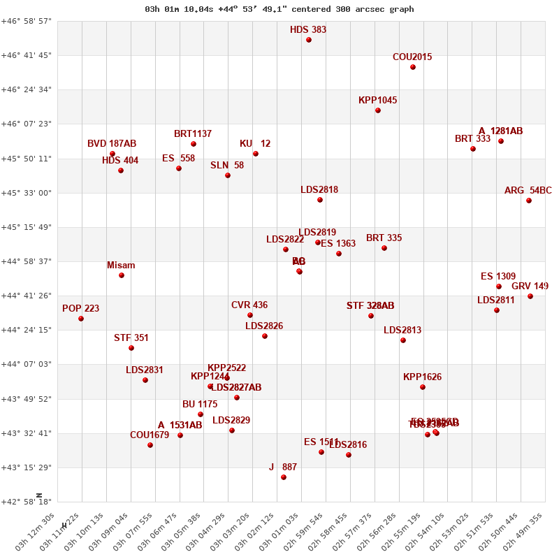
WDS 03011+4453 : VIRTUAL EYEPIECE

Click on the map to see the double of your interest.
Pass over with the mouse cursor to display the catalog designation.
|
|
WDS 03011+4453 : ALADIN DSS IMAGE @ 03h 01m 10.04s +44° 53' 49.1"
WDS 03011+4453 HJ 2167 BC : NEIGHBORHOODS
|
|
Click on the map to see the double of your interest.
Pass over with the mouse cursor to display the catalog designation.
|
| Show |
name |
coord_2000 |
discov# |
comp |
pa |
sep |
dist(') |
| Show |
|
03011+4453 |
HJ 2167 |
BC |
87 |
42.7 |
|
| Show |
|
03011+4453 |
HJ 2167 |
AB |
34 |
37.7 |
1 |
| Show |
|
03011+4453 |
HJ 2167 |
AC |
62 |
71.9 |
1 |
| Show |
|
03018+4504 |
LDS2822 |
|
197 |
152.8 |
13 |
| Show |
|
03003+4508 |
LDS2819 |
|
220 |
13.8 |
18 |
| Show |
|
02593+4502 |
ES 1363 |
|
207 |
5.8 |
22 |
| Show |
|
03035+4432 |
CVR 436 |
|
328 |
13.0 |
34 |
| Show |
|
03002+4530 |
LDS2818 |
|
2 |
9.1 |
37 |
| Show |
|
03027+4421 |
LDS2826 |
|
300 |
7.8 |
38 |
| Show |
|
02578+4431 |
STF 328 |
AB |
306 |
14.7 |
43 |
| Show |
|
02578+4431 |
STF 328 |
AC |
96 |
46.2 |
43 |
| Show |
|
02578+4431 |
B 9001 |
AD |
117 |
100.0 |
43 |
| Show |
|
02571+4505 |
BRT 335 |
|
286 |
3.0 |
45 |
| Show |
|
03045+4542 |
SLN 58 |
|
94 |
6.5 |
60 |
| Show |
|
03032+4553 |
KU 12 |
|
144 |
3.0 |
63 |
| Show |
|
02563+4419 |
LDS2813 |
|
273 |
8.5 |
63 |
| Show |
|
03045+4400 |
KPP2522 |
|
52 |
22.8 |
65 |
| Show |
|
03041+4351 |
LDS2827 |
AB |
63 |
38.8 |
71 |
| Show |
|
03041+4351 |
LDS2827 |
Aa,Ab |
314 |
0.8 |
71 |
| Show |
|
03053+4356 |
KPP1244 |
|
136 |
9.6 |
74 |
| Show |
|
03068+4545 |
ES 558 |
|
|
8.4 |
79 |
| Show |
|
03062+4558 |
BRT1137 |
|
317 |
5.7 |
83 |
| Show |
|
02553+4356 |
KPP1626 |
|
310 |
12.5 |
86 |
| Show |
|
03042+4335 |
LDS2829 |
|
106 |
4.7 |
87 |
| Show |
|
03058+4342 |
BU 1175 |
|
275 |
0.7 |
88 |
| Show |
Misam |
03095+4451 |
ES 2596 |
AB |
319 |
44.1 |
89 |
| Show |
|
02574+4614 |
KPP1045 |
|
188 |
8.4 |
90 |
| Show |
|
03001+4323 |
ES 1511 |
|
280 |
6.9 |
92 |
| Show |
|
03090+4415 |
STF 351 |
|
115 |
27.1 |
93 |
| Show |
|
03082+4400 |
LDS2831 |
|
181 |
76.1 |
95 |
| Show |
|
02588+4322 |
LDS2816 |
|
281 |
244.2 |
96 |
| Show |
|
02518+4446 |
ES 1309 |
|
214 |
4.7 |
101 |
| Show |
|
02519+4434 |
LDS2811 |
|
305 |
3.9 |
102 |
| Show |
|
03095+4544 |
HDS 404 |
|
20 |
0.5 |
102 |
| Show |
|
03067+4332 |
A 1531 |
AB |
246 |
3.6 |
102 |
| Show |
|
03067+4332 |
KUI 12 |
AC |
177 |
47.2 |
102 |
| Show |
|
03019+4311 |
J 887 |
|
216 |
3.6 |
104 |
| Show |
|
02551+4332 |
TDS2385 |
|
231 |
0.5 |
105 |
| Show |
|
02530+4556 |
BRT 333 |
|
240 |
3.9 |
106 |
| Show |
|
02548+4332 |
ES 2595 |
CD |
3 |
10.7 |
106 |
| Show |
|
02548+4332 |
HJ 2162 |
AB |
41 |
12.6 |
108 |
| Show |
|
02548+4332 |
HJ 2162 |
AC |
54 |
68.8 |
108 |
| Show |
|
03099+4552 |
BVD 187 |
AB |
198 |
12.6 |
110 |
| Show |
|
03113+4431 |
POP 223 |
|
181 |
15.3 |
112 |
| Show |
|
03081+4327 |
COU1679 |
|
3 |
0.5 |
115 |
| Show |
|
03007+4650 |
HDS 383 |
|
147 |
0.1 |
116 |
| Show |
|
02502+4441 |
GRV 149 |
|
275 |
16.1 |
117 |
| Show |
|
02558+4636 |
COU2015 |
|
206 |
0.5 |
117 |
| Show |
|
02517+4559 |
A 1281 |
AB |
151 |
0.7 |
120 |
| Show |
|
02517+4559 |
RAO 45 |
AC |
82 |
15.2 |
120 |
| Show |
|
02503+4529 |
ARG 54 |
BC |
343 |
7.3 |
120 |
|
|
WDS 03011+4453 : COMPONENTS
| |
A |
B |
| B |
pa=34.0°
sep=37.63"
| |
| C |
pa=53.3°
sep=56.18"
| pa=84.4°
sep=24.14"
|
03011+4453 A
| Name |
HD 18613 |
|
Coord arcsec 2000 |
030108.06+445317.9 |
|
Mag |
9.23 |
|
Spectral class |
F5 (yellow-white) |
|
| PmRA |
56.00 |
|
PmDE |
-34.0 |
|
SAO |
38510 |
|
Tycho2 |
2859-00615-1 |
|
| HD |
18613 |
|
DM |
BD+44 612 |
|
| Tycho2 |
2859-00615-1 |
|
Pflag |
|
|
RAmdeg |
45.28358616 |
|
DEmdeg |
44.88831859 |
|
| PmRA |
56.7 |
|
PmDE |
-32.8 |
|
E RAmdeg |
11 |
|
E DEmdeg |
11 |
|
| E pmRA |
1.0 |
|
E pmDE |
1.0 |
|
EpRAm |
1989.95 |
|
EpDEm |
1989.86 |
|
| Num |
7 |
|
Q RAmdeg |
0.8 |
|
Q DEmdeg |
0.8 |
|
Q pmRA |
0.9 |
|
| Q pmDE |
0.9 |
|
BTmag |
9.535 |
|
E BTmag |
0.021 |
|
VTmag |
9.229 |
|
| E VTmag |
0.019 |
|
Prox |
377 |
|
TYC |
T |
|
HIP |
|
|
| CCDM |
|
|
RAdeg |
45.28339944 |
|
DEdeg |
44.88839694 |
|
EpRA 1990 |
1.56 |
|
| EpDE 1990 |
1.47 |
|
E RAdeg |
10.6 |
|
E DEdeg |
11.4 |
|
Posflg |
|
|
| Corr |
-0.1 |
|
| SAO |
38510 |
|
DelFlag |
|
|
RA1950 |
|
|
PmRA1950 |
0.0007 |
|
| DE1950 |
|
|
PmDE1950 |
-0.045 |
|
Vmag |
9 |
|
SpType |
F5 |
|
| Double code |
|
|
Source |
4 |
|
CatNum |
306 |
|
DM |
BD+44 612 |
|
| DMcomp |
|
|
BDsup |
|
|
HD |
18613 |
|
M HD |
0 |
|
| GC |
|
|
RA1950rad |
0.77573866 |
|
DE1950rad |
0.78001329 |
|
PmRA2000 |
0.0007 |
|
| PmDE2000 |
-0.049 |
|
03011+4453 B
| Coord arcsec 2000 |
030110.04+445349.1 |
|
Coord calc |
030110.04+445349.1 |
|
Mag |
10.06 |
|
PmRA |
58.00 |
|
| PmDE |
-35.0 |
|
Tycho2 |
2859-00647-1 |
|
Calc delta mag |
0.83 |
|
| Tycho2 |
2859-00647-1 |
|
Pflag |
|
|
RAmdeg |
45.29185603 |
|
DEmdeg |
44.89698285 |
|
| PmRA |
59.2 |
|
PmDE |
-34.1 |
|
E RAmdeg |
19 |
|
E DEmdeg |
21 |
|
| E pmRA |
1.1 |
|
E pmDE |
1.1 |
|
EpRAm |
1986.63 |
|
EpDEm |
1985.74 |
|
| Num |
7 |
|
Q RAmdeg |
1.0 |
|
Q DEmdeg |
1.1 |
|
Q pmRA |
1.0 |
|
| Q pmDE |
1.2 |
|
BTmag |
10.593 |
|
E BTmag |
0.041 |
|
VTmag |
10.061 |
|
| E VTmag |
0.034 |
|
Prox |
377 |
|
TYC |
T |
|
HIP |
|
|
| CCDM |
|
|
RAdeg |
45.29166750 |
|
DEdeg |
44.89706306 |
|
EpRA 1990 |
1.55 |
|
| EpDE 1990 |
1.42 |
|
E RAdeg |
21.6 |
|
E DEdeg |
24.3 |
|
Posflg |
|
|
| Corr |
-0.1 |
|
03011+4453 C
| Coord arcsec 2000 |
030112.30+445351.4 |
|
Mag |
12.82 |
|
PmRA |
6.00 |
|
PmDE |
-14.0 |
|
| Calc delta mag |
3.59 |
|
Calc coord |
yes |
|